New in The Lab: MyStreets, A Crowdsourced Pulse of Your Neighborhood
Ask someone what their neighborhood is actually like and you'll get an opinion, not data. Ask ten people and you'll get ten different opinions, shaped by which block they live on, which street they walk, which news story they read last week. There's no shared, ground-level picture - just anecdotes and Nextdoor threads.
That's the gap MyStreets is built to close.
What MyStreets Does
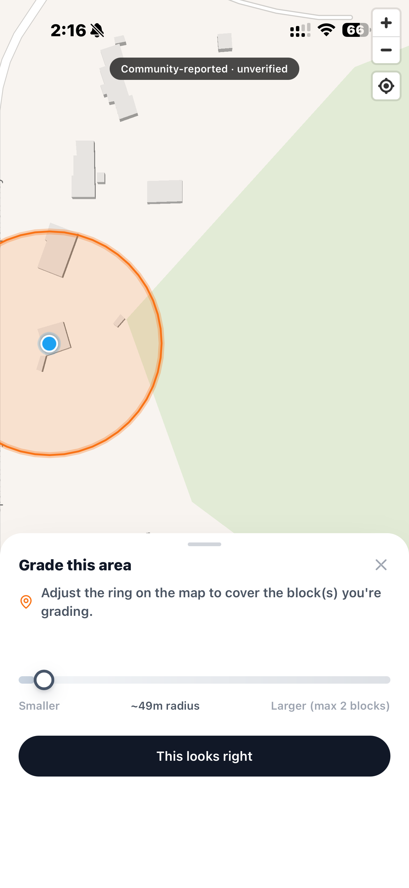
MyStreets is a mobile-first, crowdsourced heatmap of street and neighborhood conditions: trash and dumping, vacancy, homelessness, kept-up yards, kids playing outside, and more. Anyone can drop a report from their phone - pick a category, set a severity, submit. It's anonymous by design, and every submission is GPS-gated, meaning you can only report on the block you're actually standing on. No armchair reporting on neighborhoods you've never visited.
The result renders as a full-screen, pan-and-pinch-zoom heatmap you can filter by category and severity, so you can see at a glance where a neighborhood is trending positive - kept yards, kids outside - and where it isn't. We're launching with complete coverage of Reno-Sparks, Nevada, but the data model (H3-indexed, chunked into cached snapshot blobs) was built from day one to shard across all 50 states plus DC, so expanding coverage is a data problem, not a rebuild.
Why Ground-Level, Not Aggregate
Plenty of tools already claim to score neighborhoods - crime indices, school ratings, walkability scores. Almost all of them are aggregates of aggregates: government datasets, months old, rolled up to the zip-code level. They tell you about a zip code. They don't tell you what's on your actual street this week.
- Government open data is real but lagged, often quarterly or annual, and rarely resolves below a census tract.
- Review-style neighborhood apps skew toward complaints and toward whoever posts most, not toward a representative picture.
- Realtor/walkability scores are built for a home-buying decision once, not for tracking how a block is actually changing.
MyStreets' bet is that the most honest picture of a neighborhood comes from the people physically standing in it, reported often enough and anonymously enough that no single voice dominates the map. GPS-gating isn't a growth gimmick - it's the mechanism that keeps the data honest.
Built Like the Rest of the Lab
Under the hood, MyStreets is a React/Vite PWA with a MapLibre GL JS heatmap, installable straight to a phone's home screen with no app store. The backend is Azure Functions writing GPS-proximity-checked, rate-limited submissions into H3-indexed Table Storage, with an on-demand snapshot generator so the client never has to query raw rows to render the map. Every report carries a persistent "community-reported, unverified" disclaimer - MyStreets shows what people are seeing, not a certified fact.
Every neighborhood has a pulse. MyStreets is our attempt to actually put it on a map.
© 2026 Huntoso LLC. All rights reserved.